Fichier:Europe regions.png

Taille de cet aperçu : 688 × 600 pixels. Autres résolutions : 275 × 240 pixels | 2 000 × 1 743 pixels.
Fichier d’origine (2 000 × 1 743 pixels, taille du fichier : 815 Kio, type MIME : image/png)
Mało aktualna mapa
Description
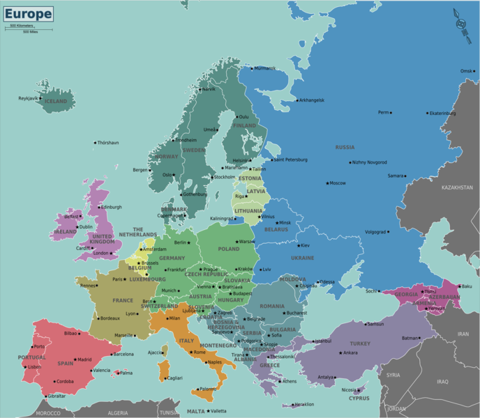
| Description | Map of Europe for use on Wikivoyage, English version |
| Date | |
| Source | Travail personnel based on the blank map of Europe by Historicair |
| Auteur | Stefan Ertmann, minor amendments by Joelf |
| Autres versions |
[]
Notes:
|
.svg)

.png)
.png)
.png)
.png)
.png)
.png)
.png)
.png)
.png)
-%E6%AC%A7%E6%B4%B2%E5%85%A8%E5%9B%BE.png)

.svg)


.png)


Conditions d’utilisation
Ce fichier est disponible selon les termes de la licence Creative Commons Attribution – Partage dans les Mêmes Conditions 3.0 (non transposée).
- Vous êtes libre :
- de partager – de copier, distribuer et transmettre cette œuvre
- d’adapter – de modifier cette œuvre
- Sous les conditions suivantes :
- paternité – Vous devez donner les informations appropriées concernant l'auteur, fournir un lien vers la licence et indiquer si des modifications ont été faites. Vous pouvez faire cela par tout moyen raisonnable, mais en aucune façon suggérant que l’auteur vous soutient ou approuve l’utilisation que vous en faites.
- partage à l’identique – Si vous modifiez, transformez, ou vous basez sur cette œuvre, vous devez distribuer votre contribution sous la même licence ou une licence compatible avec celle de l’original.
Journal des téléversements d’origine
| Ce fichier a été téléversé à partir de Wikivoyage WTS. |
La page de description originale était ici. Tous les noms d'utilisateur qui suivent se rapportent à wts.wikivoyage-old.
org:
- 2012-09-06 20:18:17 2000×1743 (834,087 bytes) Atsirlin cleanup
- 2012-01-22 15:56:09 1500×1305 (575,498 bytes) (WT-shared) Globe-trotter fixed some city names (Import from wikitravel.org/shared)
- 2011-08-02 01:40:36 1500×1305 (574,164 bytes) (WT-shared) Globe-trotter changed the color of France to make it match the colors of the USA map (Import from wikitravel.org/shared)
- 2011-06-11 21:34:01 1500×1307 (580,371 bytes) (WT-shared) Peterfitzgeraldtypo (Import from wikitravel.org/shared)
- 2011-01-03 22:33:05 1500×1307 (541,154 bytes) (WT-shared) Joelf Switched France to BurlyWood colour as a new category. (Import from wikitravel.org/shared)
- 2011-01-03 04:40:25 1500×1307 (541,072 bytes) (WT-shared) Joelf Switched France from yellow (like Benelux) to orange (like Italy). (Import from wikitravel.org/shared)
- 2010-10-29 03:45:17 1500×1307 (541,280 bytes) (WT-shared) Joelf (Import from wikitravel.org/shared)
- 2009-02-01 19:43:04 1500×1305 (573,754 bytes) (WT-shared) Sertmann (Import from wikitravel.org/shared)
- 2009-02-01 19:41:02 1500×1305 (573,783 bytes) (WT-shared) Sertmann (Import from wikitravel.org/shared)
- 2009-02-01 18:01:10 1500×1305 (570,464 bytes) (unchanged from previous upload) (WT-shared) Sertmann (Import from wikitravel.org/shared)
- 2009-02-01 18:00:05 1500×1305 (570,464 bytes) (WT-shared) Sertmann (Import from wikitravel.org/shared)
- 2009-02-01 06:01:28 1500×1305 (541,383 bytes) (WT-shared) Sertmann (Import from wikitravel.org/shared)
- 2009-02-01 05:35:21 1500×1300 (540,297 bytes) (WT-shared) Sertmann {{Imagecredit|credit=Stefan Ertmann|captureDate=January 2008|location=Europe|source=http://commons.wikimedia.org/wiki/File:Blank_map_of_Euro (Import from wikitravel.org/shared)
Historique du fichier
Cliquer sur une date et heure pour voir le fichier tel qu'il était à ce moment-là.
| Date et heure | Vignette | Dimensions | Utilisateur | Commentaire | |
|---|---|---|---|---|---|
| actuel | 21 novembre 2012 à 15:11 | | 2 000 × 1 743 (815 Kio) | OgreBot | (BOT): Uploading old version of file from wts.wikivoyage-old; originally uploaded on 2012-09-06 20:18:17 by Atsirlin |
Utilisation du fichier
La page suivante utilise ce fichier :
